Parish Representative:
Ivan Clark
Introduction
Covering 6252ha (15449 acres), Whittingehame is the largest of all of East Lothian’s parishes. Overlooked by the mass of Traprain Law in Prestonkirk parish to the north, it stretches eleven miles south through arable farmland and on to the hill farms of the Lammermuirs. The parish has two main watercourses: the north of the parish is traversed by Whittingehame Water (also known as the Papana Burn), en route to the sea at Belhaven; the Whiteadder Water runs through the southeast corner, feeding the Whiteadder reservoir, and forming the boundary with Stenton to the east. The Thorter Burn marks the boundary with Garvald to the west, and the small Thorters reservoir (12 acres) lies in both parishes.
The main settlement area is around Luggate Burn, in the north, with the various properties associated with Whittingehame estate nearby. By the end of the period, the previously tied farm cottages here were either let or sold, and some were derelict. North of a line from Stoneypath to Stoneypath Tower, the parish was by 2000 more intensively farmed, resulting in the removal of dangerous trees and some hedgerows to enlarge the fields.
Many of the farms have retained most of their original buildings, complete with steadings and pantile roofs. The main alteration on arable farms has been the addition of custom-built grain stores, incorporating grain driers and bins, and on stock farms in the hill area, the addition of sheep and cattle housing.
By 2000, the appearance of the parish has sadly declined. Although still an attractive rural area, the lack of maintenance of the roads and verges by the council, and the presence of some areas of poorly maintained fencing and hedging has detracted from its appearance. From the 1980s, the loss of numerous hedgerow and roadside elms from Dutch elm disease contributed to the changing appearance of the parish.
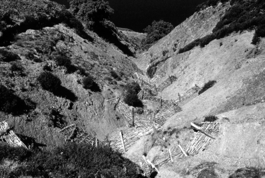
Image: Whiteadder, July 1972