Parish Representative:
Jean Shirlaw (Gladsmuir) & Kathy Fairweather (Macmerry)
Parish Editor:
Kathy Fairweather CBE
Introduction
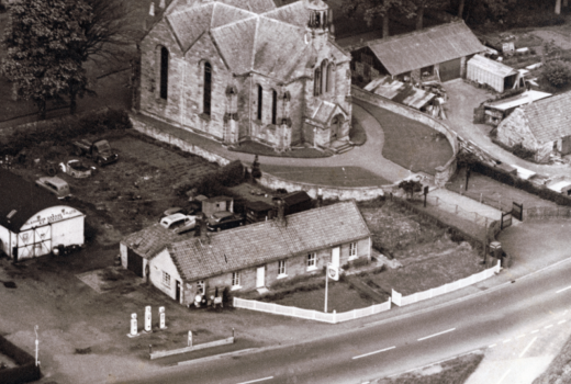
Gladsmuir parish (including Longniddry) covers some 2908 ha (7186 acres). Created in 1692 from parts of the parishes of Haddington, Aberlady and Tranent (which may account for its odd shape), Gladsmuir was something of a contrivance and always contained a mixture of coastal and inland, farming and industrial areas. After the second world war, the coastal settlement of Longniddry expanded and developed a life of its own, with its own church, school, shops and facilities, and in 1967 this was recognised when it became part of the registration district of Prestonpans; meanwhile, the civil parish boundaries remained unchanged. For the purpose of this account, the parish of Gladsmuir includes the main settlement at Macmerry, a smaller settlement at Gladsmuir, and surrounding farmland, which does not necessarily look to either settlement for services. A separate account is given on Longniddry.
Before, during and for a short time after, the war, a large area of land belonging to Hoprig Mains Farm was used as an airfield (see Economy). In 1945, parish life was dominated by the airfield; there were numerous huts and other buildings housing the military on Penston farm where around 1000 men were stationed. Today there are eleven of the original buildings remaining, which are used to store machinery. The effects on civilian life in the parish were considerable. Macmerry Primary School, for example, was closed for the duration of the war, and children had to attend schools in Tranent, Longniddry or Pencaitland.
By 2000, there were still some physical traces of these wartime activities, but the predominant changes were the building of roads, especially the new A1 expressway with its flyovers, slip roads and roundabouts, the development of the Macmerry Industrial Estate and the continued house building in Macmerry, which all had a major impact on the appearance of the parish. However, rural areas of the parish changed relatively little over the 55 years. There has been little house building outwith existing settlements, and farmhouses, steadings, rows of cottages, trees and fields, mostly still enclosed by hedges, leave the farms easily recognisable. In 1945, land in the parish was used predominantly for agriculture and, although this was in decline throughout the period, by 2000 it still occupied the greatest area of land.