Land ownership | Townscapes, Buildings & Landscapes of Distinction
The parish boundary has not been changed; all the voters still have to come to the village at parliamentary or council elections. When the community councils were inaugurated in 1975, the area immediately south of Gifford on the west side of the Duns road was included in Gifford, as those who lived there naturally considered Gifford their local centre.
Garvald is an attractive parish. To the north and east the landscape is peppered with solid stone farmhouses, flanked by red sandstone cottages, huge barns and cattle courts, and often an established shelterbelt of planted woodland. The parish is fortunate in having a very rich collection of established trees both native and introduced; there are also later plantations, particularly of conifers. The appearance of the setting of the village was changed when the bank across the Papana was planted with spruce in the late 1950s.
To the south and west the country is more open, with a scattering of settlements. Established reservoirs – the Hopes, Danskine Loch, the Donolly and Thorters – further enhance the attractiveness of the upland scenery. The Papana is the main watercourse, with tributaries of Yester Water to the west.
There was remarkably little change in the general appearance of the countryside in 50 years. The same crops were grown and a few of the fields used for grazing. The main changes in appearance were due to the increased mechanisation, and the machines used increased in size. Field gates became too narrow and in the 1980s and 1990s their width was doubled, two prefabricated iron gates being used instead of one.
The old stone dykes still surrounded the fields; in a few cases two fields had been made into one. In the western part of the parish, where the land was originally part of the Yester estate, many of the fields were tree-lined, especially with beeches planted by the Hays. In the late 20th century these trees passed their maturity and had to be felled. If the fields were used for pasture the dykes were lined with wire fencing. At Tanderlane for many years in the 1970s and 1980s an Irish labourer was employed on piecework to maintain the many dykes on the ‘painting the Forth Bridge’ principle.
Since the parish has large areas of unspoilt moorland as well as the many woodlands and rough volcanic outcrops the native flora is very large. Similarly there is a very varied fauna, such as mountain hares, foxes, badgers and grey and red squirrels; many different birds – pheasants, grouse, dippers, the occasional heron and flights of geese and swans. In April 1999, a young golden eagle was spotted in the hills to the south.
There are two Sites of Special Scientific Interest (SSSI) within the parish: the marshy Danskine Loch, and the Papana Water in its steep valley are both designated for their botanical value.
The Whiteadder reservoir, though not actually in the parish, was constructed during the middle part of the period to supply water to the power station at Cockenzie. The associated filtration plant is sited above Castle Moffat, with bungalows for those employed. Since these developments are in a tree-lined area, they are relatively inconspicuous. The pipeline continues underground at the east side of the parish.
The pipeline carrying North Sea gas to England cuts right across just west of the village, but there was never any possibility of Garvald having a mains gas supply.
When the route followed by the pylons bringing electricity from Torness was originally mooted, it was to follow the edge of the hill country just south of the Papana, passing directly over the new monastery. Fortunately Ian Fullerton, of the council environment department, was on our side and persuaded the planners to re-route the lines through glens in the moors where they are much less conspicuous and there are no habitations.
Land Ownership
In 1945 there were 15 separate farms in the parish. The majority of these were on the vast Yester estate, three on the Nunraw estate, one on Amisfield (Wemyss), and one on Whittingehame (Balfour).
Over the years the individual farmers have taken over ownership, and in several cases neighbouring farms were joined together so that by 2000 there were only eight owners. The Youngers at Baro and the Gibsons at Carfrae and Danskine remained the owners throughout the period through three generations.
By 2000, most of the land at Garvald Grange was farmed from Tanderlane, Chesters from Baro, Garvald Mains from Phantassie in East Linton and the Hopes from Quarryford. The Cistercian Order of monks had completed their purchase of the Nunraw estate from Marcus Spurway by early 1946. Only at Castle Mains had there been a change of use, the farm having been developed as a golf course. Three fields were still ‘glebes’ owned by the Church of Scotland.
Townscapes, Buildings & Landscapes of Distinction
Garvald village and the immediate environs were designated a Conservation Area in 1979. Planners, and Frank Tindall in particular, carefully monitored proposed changes. His determination that development and modernisation were in keeping with existing style ensured that in 2000, Garvald was one of the most attractive of all the hillfoot villages.
The most striking development was the building of the new monastery at Nunraw on open country on the west side of the old estate. Designed by Peter Whiston, it is visible for miles around, particularly from the south-eastern approach to the village; the grey stone was brought from the Rattlebags Quarry at Dirleton, and contrasts with the old village and church, which are mainly built of old red sandstone, the local building stone (the main disused quarry is half a mile up the Papana from the village on the south side of the burn).
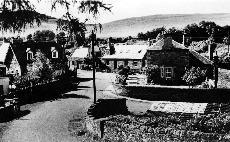
Bridge End, Garvald
In 1945, the archbishop of St Andrews & Edinburgh suggested the estate of Nunraw, Garvald as a possible site for a new Catholic community; the owner, Marcus Spurway, was willing to sell the old house and the surrounding farmland. On February 2 1946, the first seven monks took possession and the Archbishop McDonald celebrated the first Mass in Nunraw House.
On 21 November 1947, the monastery became an abbey, and the Right Rev Dom Columba Mulachy became the first Abbot, receiving an Abbatial Blessing on February 2 1948: after 400 years, Scotland again had a Cistercian Abbey. The first sod of the new abbey was dug on Easter Monday, April 14 1952 and the foundation stone was laid on August 8 1954 in the presence of 13,000 people. Between 1952 and 1969, the main buildings were erected, the refectory, scriptorium, library and dormitory. Volunteers came each summer to help the monks with the building work, living in the old huts behind the village pub.
Archbishop Keith O’Brien worked on the Abbey as a young seminarian, ‘apprenticed’ as a labourer to stonemason Willie Tear. The Scotsman related this tale (10 December 2002):
Willie was a good socialist, Presbyterian and mason who called a spade a shovel. One day Willie opened his lunchbox. “Some bastard’s stolen ma’ aipple” He looked over the wall and there was the young O’Brien munching away. When he got home, he said to his wife: “De ye ken what that wee bastard did? He stole ma’ aipple” Mrs Tear said nowt. Next morning, she made up his lunchbox as usual, and Willie kept a keen eye on it till lunchtime. When he opened it, there were two apples inside.
The north wing is presently used as a church, and the real church building is planned on the east side. The old Nunraw House functions as a guesthouse, with Father Raymond in charge.
On 16 December 1969 Father McGlynn became the second Abbot. During the 1990s, several of the original members of the order died, and there were few recruits to replace them.
The Hopes is an A grade listed building, that had mixed fortunes over the period, lying empty for long periods, and changing hands a number of times. Owned in 1945 by the Marquis of Tweeddale, the house at the Hopes was tenanted by Robert Stuart between 1948-63. Bob Stuart is best remembered for his ‘Dungledozer’, which featured in the 1953 Royal Highland Show, and the Hopes compost club!
Empty from 1963, the Hopes was sold in 1966/67 to Messrs Parker and Morris, who moved in c1968. By 1970, they had moved on to Yester, leaving the Hopes empty again, until it was purchased, and occupied, by J. Martin in 1972. The Hopes was reunited with its farmland when it was sold to Faccombe Estates in 1991. By 2003, the Hopes was welcoming paying guests in search of the ‘ultimate holiday experience’.
Quarryford was purchased in about the 1970s by Dr Innes Lumsden, who then built the impressive Dutch-style farmhouse there.
Baro, Linplum and Linkylea: long before the time of this survey, all the land at Baro was one estate owned by a branch of the Hay family of Yester. The land stretched from the roundel, the clump of trees left of the Gifford-Garvald to Morham road, and there have been a number of developments in the housing.
Linplum is a late Victorian country house with its own grounds.
Just before the second world war the Youngers bought Baro and had just started to build the mansion house on the south side of the Gifford road. Unfortunately Colonel Younger was killed, so his widow completed the house in the 1940s. Meantime she lived in the main farmhouse; a distinguished botanist, she developed a beautiful garden there.
Her son lived in the mansion house, the grieve in the house next to the farmhouse, beside the steadings. The row of cottages beside the road was mainly occupied by farm workers. There was also a row of cottages in the field called Linkylea, opposite the end of the Linplum drive, occupied by retired workers and others.
On the north side of this drive were the ruins of the old Linplum farmhouse, the steadings and even the original 14th century tower house of Linplum, which had a commanding view across the low-lying land to Haddington. In the 1970s, this area of land, including all the ruins was sold, and a modern house incorporating some of the old walls was built and occupied in 1979. It has a large garden that includes the base of the tower house. To distinguish it from Linplum House next door, it was decided to call it Linkylea House since the cottages of that name already existed across the road. Most years, the owners open this rather wonderful garden as part of the Scotland Gardens Open Scheme. Including the old Baro graveyard to the east of Linplum, this is an important historical site.
Meantime on the south side of the Gifford road, planted woodlands matured over this period, with a lake dammed in the glen and further plantations on the bank to the south.
In the 1980s a modern bungalow, now occupied by the farm manager, and modern steadings were built in the field called East Moory, just to the west of the old farmhouse. The acreage of land was increased when that of Chesters farm was added. The old Baro glebe on the east side of the farm is still owned by the Church of Scotland but is worked as part of the Baro land.
The parish’s rich collection of introduced trees was mainly due to the foresight of the landowners in the past, particularly the Hay family. For example, in 1829 Robert Hay (who owned both Nunraw and Linplum) bought 91,400 young trees (costing £65.11s.9d) and many reached maturity in the latter part of the 20th century. Unusual examples are the eucalyptus, silver fir and evergreen oak by the ‘doocot’ at Nunraw and the monkey puzzles, cedar of Lebanon and Wellingtonia in the fields.