Parish Representative:
Irene Anderson MBE
Introduction
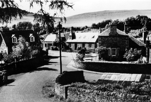
Stretching from the top of the Lammerlaw for nearly ten miles in a north-easterly direction, Garvald parish crosses a wide variety of types of scenery. It covers some 545ha (13455 acres). In the south, there is a wide area of heather-covered moorland. On the slopes of the Lammermuir Hills, the fields are permanent pasture for hill farming, with reservoirs and burns in the glens. The southern upland geological fault bisects the parish and north-east of it are rich arable fields, woodlands, drystane dykes and old established farm steadings. The only village is in the north-east corner of the parish, hidden in the glen eroded by the Papana Water. Modernisation has made little difference to its appearance. A long line of cottages, some of red sandstone with pantiles, others whitewashed with slate roofs, lay either side of the main street, with the 12th century parish church at the eastern end. The most striking innovation is the new Cistercian monastery of Nunraw on the hillside to the south of the village.