Land ownership | Townscapes, Buildings & Landscapes of Distinction | Listed Buildings
The land in the parish mainly comprises fertile farmland, rising to moorland on the northern slopes of the Lammermuir Hills. The 1953 survey (p63) noted that Humbie contained some of the best hill farms in the county. In the 1980s and 1990s there was a significant loss of trees, in particular hedgerow trees, due to Dutch elm disease and the felling of over-mature trees which endangered road traffic. There are still however many beautiful wooded areas. Since the 1950s a number of additional conifer plantations have been planted as shelterbelts and as a long-term cash crop. The parish therefore has a wide variety of habitats for wildlife. Although no records exist, there is a perception that since the 1970s, perhaps due to changes in farming practices, refurbishment of old buildings, and greater road traffic, there became in some areas a lesser number of roe deer, owls, bats and smaller birds, and a greater number of badgers, sparrow-hawks and buzzards. Rabbit numbers recovered from the effects of myxomatosis in the 1950s and 1960s and control of rabbit and mole populations was a continuing battle.
A notable feature of the countryside for more than a century has been the beech hedging planted on the Humbie estate, in particular that planted in the 1860s adjacent to the main east-west road through the parish. The gardens of Humbie House and Stobshiel House have for many years been opened on occasion to the public as part of the Scotland’s Gardens Scheme and for other charities.
A small area of exposed glacial material in a side valley of the Keith Water was designated as a Site of Special Scientific Interest (SSSI).
The landscape was visually changed in a number of ways. The majority of roadside telephone wires were rerouted underground from the 1970s, but in the 1980s the power lines and pylons carrying electricity from Torness power station to central Scotland were, despite local protests, carried through the east of the parish. Two other routes with even greater impact on the parish were successfully resisted.
At the end of the 1990s, a wind-farm development on the Lammermuirs outwith the parish was, nevertheless visible and visually intrusive to some, although an interesting feature of the skyline to others. The community accepted in compensation a small annual ex-gratia payment from the power company for local projects.
Many of the characteristic East Lothian County Council finger posts, erected in the early days of motoring, and marked in eighths of a mile for the non-motorised road users of the day, were replaced or had fallen into disrepair. In the late 1990s the local authority commenced a programme of refurbishment and reintroduction of these signs, although by 2000 no improvements had been made in Humbie.
Land Ownership
The 1945 East Lothian Yearbook identified seven ‘mansion houses’ and 17 farm properties within the parish.
The term ‘mansion house’ is not defined in the East Lothian Yearbooks; it is taken here to mean ‘substantial house originally built by owner of surrounding land’.
| Property | Owner (1945) | Occupier/status (1945) | Occupier/status (1969) | Occupier/status (2000) |
|---|---|---|---|---|
| Keith Marischal | Skene Tytler Mrs | Skene Tytler Mrs prop | Matthew Prof RH prop | Matthew Lady L & A prop |
| Humbie House | Bayne-Jardine Brig CW | Bayne-Jardine Brig CW prop | Bayne-Jardine C C & others prop | Laing R prop |
| Stobshiel | Nisbet Mrs J | Nisbet Mrs J prop | Nisbet Miss C prop | Ward M prop |
| Johnstoun-burn | Crookshank Col | Crookshank Col prop | Trustees of Elworthy F | Grace Hotels prop |
| Whitburgh* in EL to 1987 | Baron Whitburgh | Baron Whitburgh | Trustees of BW | Salvesen prop |
| Chesterhill | Crookshank Col | Crauford Mrs | Hardie J prop | Hardie J prop |
| Leaston** | Stodart J? | Stodart J? | Younger D? | Menzies D prop |
| Scadlaw*** | Balfour P prop | Balfour P prop |
- * Whitburgh was transferred to Midlothian as part of district (and regional) boundary adjustments in 1987.
- ** Leaston House not included in East Lothian Yearbooks
- *** Scadlaw was built new on land at Upper Keith 1969
The farm properties were:
| Property | Owner (1945) | Occupier/status (1945) | Occupier/status (1969) | Occupier/status (2000) | |
|---|---|---|---|---|---|
| Duncrahill | Lord Hopetoun | Cadzow J | Cadzow D & Co prop | Cadzow Miss J prop | |
| Keith Marischal | Mrs Skene-Tytler | CadzowJ | (land with Duncrahill) | (land with Duncrahill) | |
| Windymains | Lord Hopetoun | Greenshields Misses JG,C&S | Greenshields & Harrison N | (land split: H. Mill/Whitburgh) | |
| Highlea | Bayne-Jardine Brig CW | Reid G,G&WA | Marshall D J | Marshall D J prop | |
| Humbie Mains | Bayne-Jardine Brig CW | Common W | Bayne-Jardine Mrs I prop | Bayne-Jardine Miss E prop | |
| Keith Hill | ??? | Forrest S | Hendry WN prop | (land with Pogbie) | |
| Newmains | Bayne-Jardine Brig CW | Greenshields T | Greenshields T | (land with Humbie Mill) | |
| Hattonhill | Bayne-Jardine Brig CW | Wood G&C | Bayne-Jardine Mrs I prop | (land with Humbie Mains) | |
| Humbie Mill & Shillinghill | ??? | Rutherford W | Hodge T&G prop | Hodge A prop | |
| Upper Keith | Crookshank Col | Nairn W | Balfour Maj PEG prop | Balfour HED prop | |
| Mavishall | Crookshank Col | Dickson A | Elworthy J prop | (land mainly with H Mill) | |
| Leaston (and Bankhead?) | Stodart C | Stodart C prop | Stodart J prop | Stodart J prop | |
| Blegbie | Lowrie J | Lowrie J prop | Trustees of JL | Lowrie C prop | |
| Whitburgh* EL to 1987 | Baron Whitburgh | Baron Whitburgh prop | Trustees of BW | Salvesen prop | |
| Pogbie | Gifford T | Gifford T prop | Gifford T prop | Torrens J prop | |
| Bughtknowe | Nisbet Mrs J | Mackintosh H J | Mackintosh H J | Nisbet J prop | |
| Stobshiel Mains | Nisbet Mrs J | Pate J&G | Pate G | Pate G prop |
Information derived from East Lothian Yearbooks for 1945 and 1969, with modifications & additions.
Five of the farm properties were owner-occupied, and the remaining twelve were tenanted from larger estates. Only two of the properties (Duncrahill and Keith Marischal) were at that time farmed by the same tenant. During the 1960s and 1970s, most originally tenanted land was purchased by the sitting tenant or was owner-occupied when the tenancy was relinquished. In the 1980s and 1990s subsequent sales combined some of the land into larger more viable units, and some hill land was sold for forestry. By 2000, the 16 operational farms listed in 1945 had been reduced to eleven, of which Whitburgh was no longer part of the parish, and some farm work had been let out to contract. Six farms were still occupied by the families of the 1945 owners or tenants.
By the 1980s all of the ‘mansion houses’ had been separated from their lands by sale to professional and business people from Edinburgh.
Townscapes, Buildings & Landscapes of Distinction
The majority of substantial Humbie properties and steadings are stone-built and slate-roofed (from a variety of sources). A small number of cottages were built on farms and in the village area in the 1940s and 1950s and have mainly roughcast walls and dark red concrete tile roofs; there are also individual examples of ‘system’ built Orlit, Dorran and Colt houses. Also in the 1950s many pantiled cottages were re-roofed with concrete tiles or with secondhand slates available from demolition works in Edinburgh.
By 2000 only two or three originally pantiled dwelling houses in the parish were still pantiled, two other former outbuildings were converted to domestic use in the 1990s and were required by planning constraints to retain their pantiled roofs. Planning constraints also required that some recent new buildings be roofed with slates (imported from Spain!).
Many originally pantiled (or slated) steading buildings were replaced with large, usually asbestos cement sheeted, buildings from the 1960s. By 2000, although small sections of pantile roofs existed in some steadings, only one had substantial pantiled areas remaining. No pantiled roofs have the slated lower courses typical of other parts of the Lothians.
Humbie Children’s Village
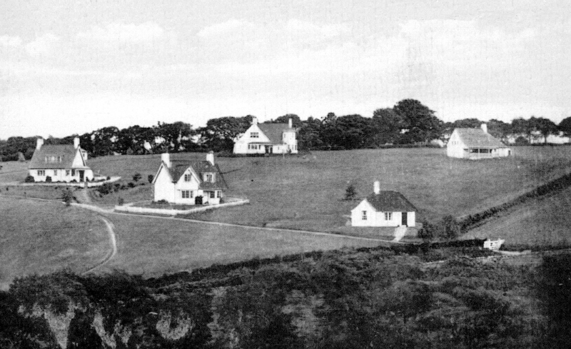
The Edinburgh Children’s Village (see also Education) has been a feature of Humbie since the early 1900s. The village was built over a period up to the 1920s in a colourful ‘Arts and Crafts’ style, on a conspicuous eleven-acre site, and after a change in use in 1967 it continued to be occupied until 1995. It subsequently remained unoccupied pending redevelopment. The Local Plan (1998) identified the children’s village as ‘a prominent feature in the landscape’, several of the buildings themselves being ‘listed’, and hence subject to planning controls, for their special architectural or historic interest. In 1999 the Children’s Village was sold to developers, but by 2000 no acceptable proposals for development had been submitted.
Listed Buildings
| Building Address | Date | Category |
|---|---|---|
| Keith Marischal House with garden wall and gatepiers | 06/01/90 | B |
| Home Steading with sheep-pen & dovecot | 06/01/90 | A |
| North Lodge | 06/01/90 | B |
| South Lodge | 06/01/90 | B |
| Humbie House with quadrant walls and gatepiers | 06/01/90 | C (S) |
| former Sawmill | 06/01/90 | C (S) |
| Johnstounburn House with garden walls | 02/05/71 | B |
| Coach House | 02/05/71 | B |
| Dovecot | 02/05/71 | B |
| Summerhouse & walled garden | 02/05/71 | B |
| Gate Lodge with entrance arch, quadrants and retaining walls | 06/01/90 | B |
| Chesterhill House with retaining walls, quadrants and gatepiers | 02/05/71 | B |
| Leaston House with retaining walls and gatepiers | 02/05/71 | B |
| Leaston Farm Grieve’s House | 06/01/90 | C (S) |
| Highlea Farmhouse | 06/01/90 | B |
| Humbie Mill House | 06/01/90 | C (S) |
| Pogbie House & garden wall | 06/01/90 | C (S) |
| Hazyhill | 06/01/90 | B |
| Keith Bridge Cottage with outbuildings | 06/01/90 | C (S) |
| Humbie Parish Church with Broun Aisle and graveyard walls | 06/01/90 | B |
| Dovecot | 02/05/71 | C (S) |
| Humbie Children’s Village: | 06/01/90 | |
| Park | C (S) | |
| The Cottage | C (S) | |
| Pettie/Petite Cottage | C (S) | |
| Ravelston | C (S) | |
| Rose | C (S) | |
| Sharon | B | |
| Harmony | C (S) | |
| School | B | |
| Village Hall/Dining Room | B | |
| Sundial | C (S) | |
| Drinking Fountain | C (S) | |
| Humbie Mill Bridge | 06/01/90 | C (S) |
| Humbie War Memorial | 06/01/90 | C (S) |
Based on information obtained from www.historic-scotland.gov.uk November 2001