
Parish Representatives:
Sheila Henderson; Jenny Lamont (Inveresk Village); & Kate Shilton (Wallyford)
Introduction
Inveresk parish is the most westerly of the county’s parishes. Part of Midlothian until 1974, it is bounded on the west by Joppa and Portobello (on the outskirts of Edinburgh) and on the east by Prestonpans and Tranent; to the south is Dalkeith. Inveresk parish covers some 2323ha (5740 acres). Parish development is somewhat constrained by green belt designation, although in recent times this was disregarded – such as at Wallyford – and the green belt re-aligned. Both the main Edinburgh-London railway line and the modern A1 road, which was opened in 1986, cut across the landward area of the parish; at the western edge the river Esk meanders south to north.
The parish contains East Lothian’s largest town – Musselburgh – and a separate account is given of this. Outwith the old burgh boundaries but within the parish lie a number of smaller settlements – which vary greatly in character and development. The three most important are Inveresk Village, Wallyford and Whitecraig.
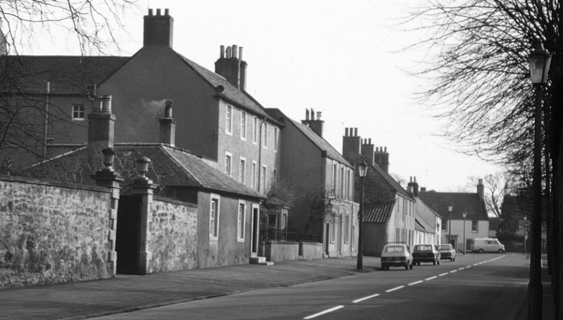
Inveresk village
Inveresk Village lies to the north of one of the great curves of the river Esk on rising ground to the south of Musselburgh. No longer separated from the burgh – the one merges into the other – the Village is dominated by an array of large residential properties, most of them set in spacious grounds. This is a leafy and wealthy part of Inveresk parish.
To the east is the growing village of Wallyford, which by 2000 bore little resemblance to the mining village of 1945. The miners’ rows, brickworks and pitheads that dominated post-war Wallyford have been replaced by rows of modern housing and an industrial estate. The proximity of Wallyford to Edinburgh made it ideal for housing expansion yet in the 1980s it was one of the poorest of all East Lothian’s communities. The turning point came when the long-awaited Musselburgh by-pass opened in 1986, making Wallyford an appealing place for the developers.
Whitecraig is a smaller settlement that again grew on the back of the mining industry; it is situated amongst prime agricultural land, much of it designated as green belt. Apart from a few developments on infill land in the 1980s, the village itself has remained largely within its 1945 boundaries.
Old Craighall is a former mining village, now hemmed in by the major roads of the A1 and the Edinburgh city bypass. Smeaton and Carberry now amount to little more than a few houses clustered together.
Of the old ‘big’ houses of Carberry Tower (east of Whitecraig), Newhailes (west of Musselburgh) and Monkton House (Old Craighall), all remain but experienced change between 1945 and 2000.