George Archibald
Coalfield Structure
In this essay:
The Lothian Coalfield lies in the form of an elongated deep trough extending from around Carlops to an undefined area under the sea beyond Musselburgh. Broadly, the coal seams outcrop steeply on the west boundary along the base of the Pentlands, but to the east the structure flattens and its seams lie at relatively shallow depths beneath East Lothian. This part of the coalfield underlying the county covers roughly 30 square miles with its boundary running from the coast at Longniddry to Gladsmuir, to Pencaitland, then across to Pathhead. The workable seams are mainly part of the Limestone Coal Group and, while there are considerable variations in thickness and quality, around twelve of the seams have been exploited.
Early Mining History
The fortuitous situation of easily accessible coal gave East Lothian a claim to fame in mining history. The first official record of coal working in Britain is in the charter granted by a Norman noble, Sieur de Quincy of Fa’side, to the monks of Newbattle Abbey around 1210, giving them the right to work his coal heugh at Whytrigg near Prestonpans. The monks used the coal to fuel their saltpans and indeed part of the road from Newbattle through Wallyford to the coast is still called Salters Road. From this early start, the coal-bearing area was continuously worked to the extent that there are recorded around 350 entries into coal in East Lothian by means of shaft, mine or adit.
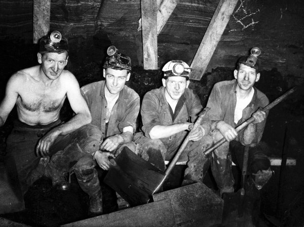
Miners at The Fleets – J McNeill, P Murray, M Gordon, R Thompson